
Published On Apr 30, 2024
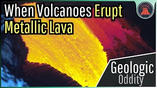
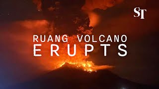
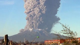
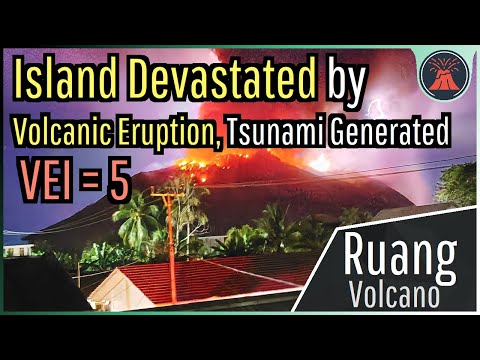
One of the strongest volcanic eruptions in the last century is believed to have wiped out a majority of Ruang Island's structures. This eruption was larger than the 1980 eruption of Mt. St. Helens, and even led to the generation of a tsunami. Hundreds of homes and structures were damaged, with this all occurring due to Ruang's 210 minute long plinian eruption. This video will discuss exactly what occurred in the last 36 hours at Indonesia's Ruang volcano.
Thumbnail Photo Credit: Bawoleh Yuanita, / yuanitagretosbawoleh , Used with Permission. This image was cropped, sharpened, overlaid with text, and then overlaid with GeologyHub made graphics (the GeologyHub logo and the image border)
NASA EOSDIS Worldview satellite imagery Copyright © 2012-2024 United States Government
as represented by the Administrator of the National Aeronautics and Space Administration.
All Rights Reserved. Associated license for NASA EOSDIS Worldview: https://github.com/nasa-gibs/worldvie...
We acknowledge the use of imagery provided by services from NASA's Global Imagery Browse Services (GIBS), part of NASA's Earth Observing System Data and Information System (EOSDIS).
We acknowledge the use of imagery from the NASA Worldview application (https://worldview.earthdata.nasa.gov/), part of the NASA Earth Observing System Data and Information System (EOSDIS).
If you would like to support this channel, consider using one of the following links:
(Patreon: / geologyhub )
(YouTube membership: / @geologyhub )
(Gemstone & Mineral Etsy store: http://prospectingarizona.etsy.com)
(GeologyHub Merch Etsy store: http://geologyhub.etsy.com)
Google Earth imagery used in this video: ©Google & Data Providers
This video is protected under "fair use". If you see an image and/or video which is your own in this video, and/or think my discussion of a scientific paper (and/or discussion/mentioning of the data/information within a scientific paper) does not fall under the fair use doctrine, and wish for it to be censored or removed, contact me by email at [email protected] and I will make the necessary changes.
Various licenses used in sections of this video (not the entire video, this video as a whole does not completely fall under one of these licenses) and/or in this video's thumbnail image (and this list does not include every license used in this video and/or thumbnail image):
Public Domain: https://creativecommons.org/publicdom...
CC BY 2.0: https://creativecommons.org/licenses/...
Sources/Citations:
[1] PVMBG (Pusat Vulkanologi dan Mitigasi Bencana Geologi) (Indonesia)
[2] VEIs, dates/years, composition, tephra layer name, DRE estimates, and bulk tephra volume estimates for volcanic eruptions shown in this video which were assigned a VEI 4 or larger and are not Ruang's 2024 eruption or Hunga Tonga-Hunga Ha'apai's 2022 eruption are sourced from the LaMEVE database (British Geological Survey © UKRI), https://www2.bgs.ac.uk/vogripa/view/c..., Used with Permission
[3] Source of Volcanic Explosivity Index (VEI) methodology and criteria: Newhall, C. G., and Self, S. (1982), The volcanic explosivity index (VEI) an estimate of explosive magnitude for historical volcanism, J. Geophys. Res., 87(C2), 1231–1238, doi:10.1029/JC087iC02p01231. Accessed / Read by / geologyhub on Oct 5th, 2022.
[4] NASA Worldview, EOSDIS Worldview, (Satellite imagery: Terra / MODIS), at https://worldview.earthdata.nasa.gov/
0:00 A Destructive Eruption
0:32 Ash Plume
1:35 Plinian Eruption
2:31 A Tsunami is Generated
3:12 Larger Than St. Helens